West Tiger #1 10mi/16km loop
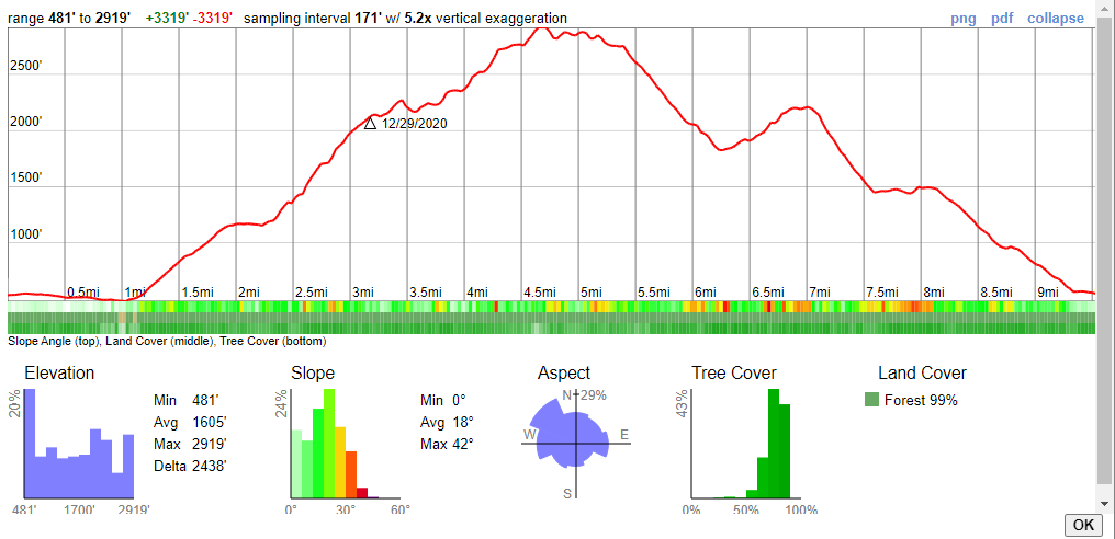
10 mile loop around West Tiger #1 with 3320 ft. of total elevation gain. A very cold hike a day before New Year's Eve
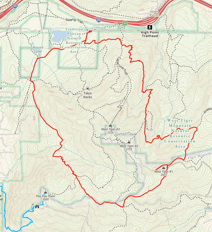
Started at 8:00 from what is marked on Google as the Highpoint Trailhead, and on GaiaGPS as Tiger Mountain Trailhead.
It began as a very cold hike, on a flat surface at freezing temperatures. We then intersected and joined the Poo Poo Point Trail aka the Highschool Trail. De-layered for the upcoming uphill. Warmth set in and the sweating started.
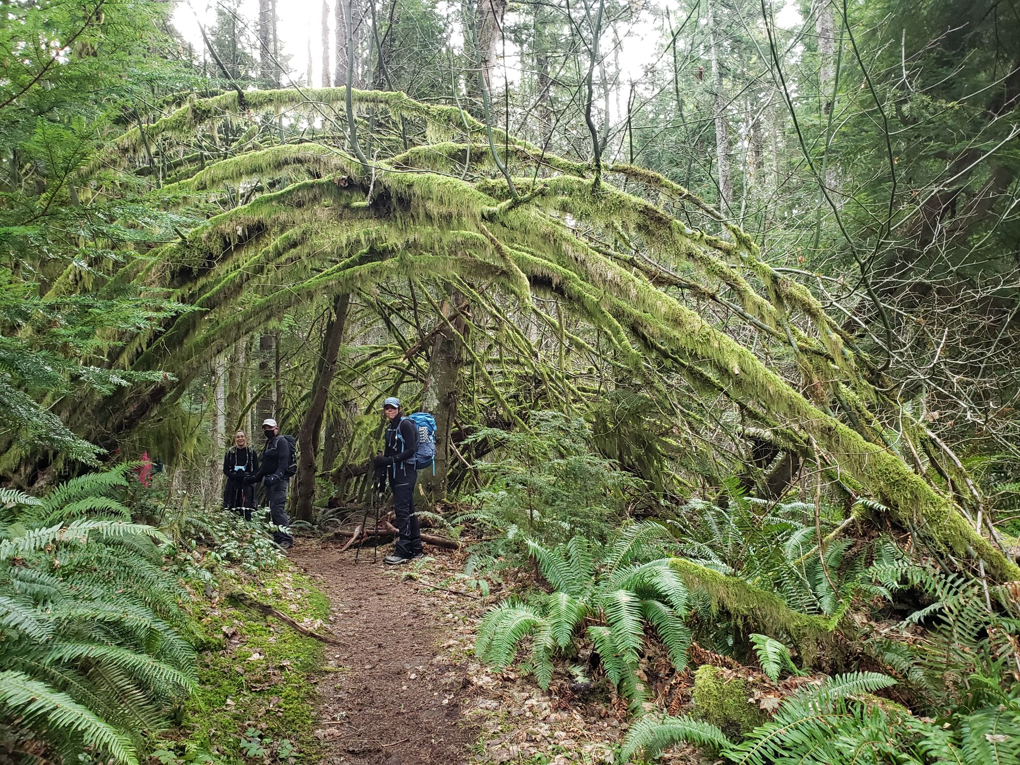
Crossed a few bridged small creeks, but for most of the uphill the feeling was of being trapped in the woods with no sights. I don't remember much of the way, except when we joined the One View Trail and stopped for a picture of some arches that looked like a middle-earth wedding place.
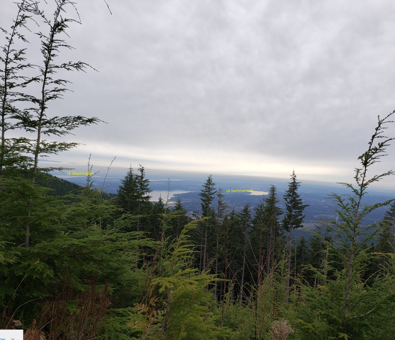
Right before reaching West Tiger #1 we followed a little bit of the West Tiger #2 trail towards the east, it seemed more like a forest service road than a trail. We reached an open area 0.1 miles ahead where the views were great. Got a sight of Lake Sammamish and Lake Washington and could spot the Columbia tower in Seattle.
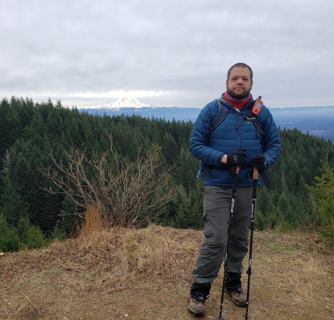
Backtracked to the Tiger #1 and went to the Hiker's Hut, where it was very windy and cold. Decided not to have lunch there due to the wind and avoided the hut due to the COVID19 thing going on. Still we got to see the mighty Mt Rainier.
An interesting fact was that even though there was no snow, you could see footprints on what used to be mud but was now frozen rock solid.
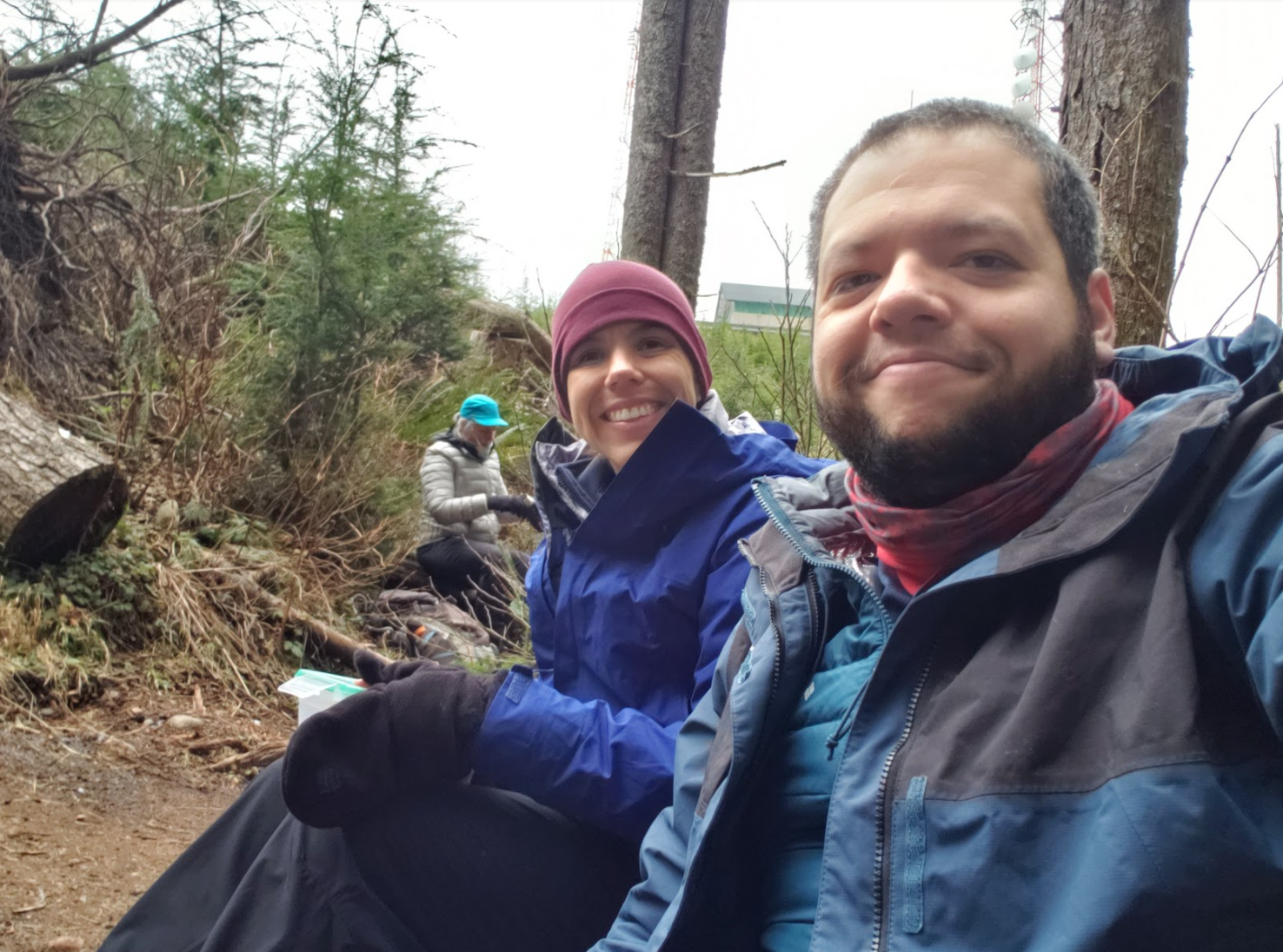
Off we went on the Preston Trail looking for some logs to sit and have lunch. After a tiring hike up, it was the most sought after part of the day!
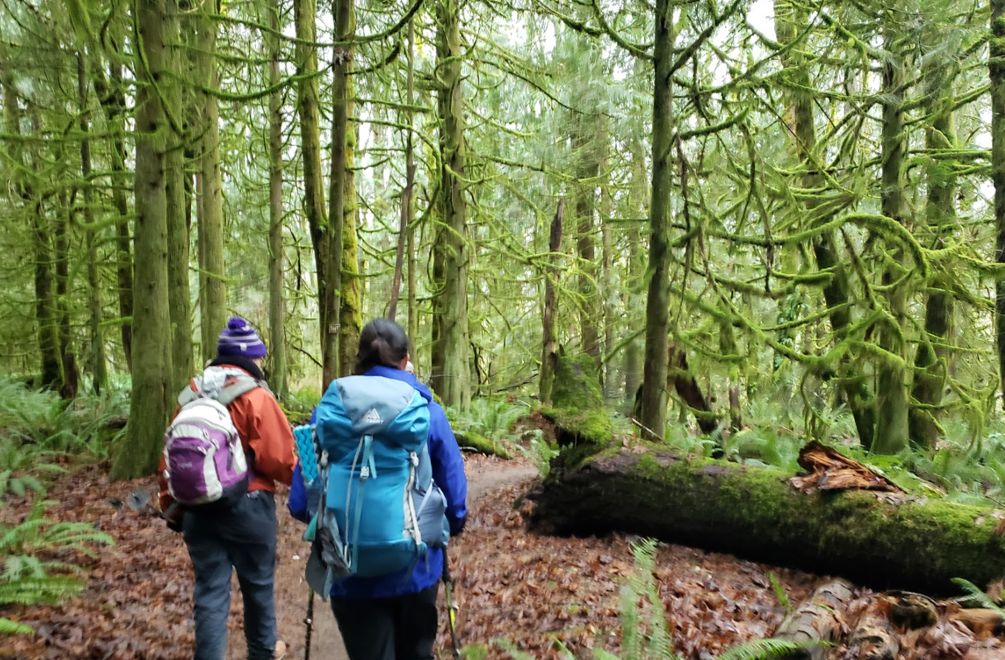
Our way back was highlighted by mossy woods and a dreaded uphill to intersect with the Tiger Mountain Trail on the east face of Tiger #2
It was enjoyable and tiring. It was a great workout!